
Our cross country route from Bend, OR, to Summerville, SC

Not sure any of you remember the tiny Toyota Corolla we drove for 6 weeks in NZ. I, for one, will not easily forget it. It was so packed full of "stuff" that we could not put the seats back for any leg room for ourselves! for 6 weeks! I mentioned to Tom that I did not think that was the place to save $$$....we spent more time in that car than in any hotel or bed n breakfast So we requested a "mid size". When we arrived at Budget.....they had no mid size.....had to upgrade to the monster shown above! Talk about space!!!! The puke green color is forgiven.....we have LOTS of space!! So far about 24 mpg.

This was a VERY welcome sign....it signaled the end to the monotony and finally, some unique landscape to view as we drive. We have had many drives across Utah...all of them very pretty, but this is a new route (we are still finding new ways!). The southwestern corner was our first choice to return to Bryce and Zion National Parks....but somehow we are on our way to Moab, the southeast corner instead!

Green, not brown
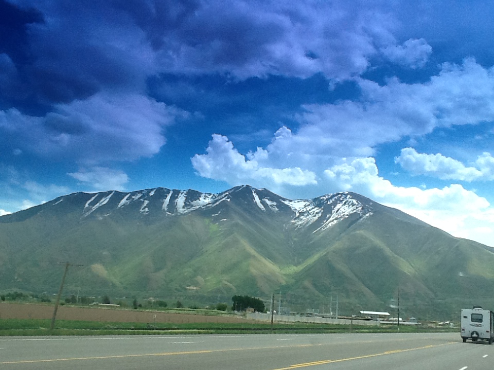
Mountains, not plains

We have seen many windmills on our cross country journeys, mostly in southern California, but never this close.....there were 10 total which is a small quantity......not sure how much power that can provide.


The landscape is increasingly impressive....one feels small as an ant passing through some of this terrain. Surprisingly, there are no warning signs for rockslides

Too bad we couldn't get close enough to get a good picture of this....we saw several cars packed like our baby Toyota was in NZ....all with college stickers, usually from the University of Idaho. It took about 3 or 4 of them for us to realize that school is out and students are going home for the summer! You cannot tell from this picture.....those are plastic boobs!!!!!


Yikes!! Storms all around us, but no rain on us!


Not long after left I-15 south of Salt Lake City we ran across this area of coal production. Apparently, it was the first area in Utah to mine the coal. Coal mining is dangerous wherever you are. The 1924 explosion killed 171 men and the 2000 explosion killed 2. Maybe that is because of the mechanization of coal mining -- fewer people under ground. But they still have explosions.


Quite an operation out in the middle of nowhere.

Even Butch Cassidy and his Wild Gang operated in this area when the mining was for gold and silver. They did pretty well for this one. A haul of $8000 would go pretty far in 1897.

The weather changes pretty fast in the part of the world. The rain would fall, but evaporate before it reached us....just a sprinkle!

We are havin' fun....much more fun than eastern Oregon and souther Idaho

It is beautiful country to pass through. The terrain can change as fast as the weather. We have reached an area filled with "mesas".....Spanish for table.....lotsa flat-topped hills/mountains.

This area was formed by selective erosion by the Colorado and Green Rivers.

Millions of years ago most of this area was under a huge sea.

The rivers took the softer material and left the harder. The soft stuff washed away to form layers at the bottom of yet another sea or ocean.


We made it to Arches National Park just outside of Moab, UT. Turns out that May is the most visited month for Arches. We arrived about 4 PM and the welcome center was full of people. Kathy had to make a run for the Ladies to beat a tour bus load of Asians who were descending on the place. We got our maps, watched a movie, and headed off to check in and let the crowds dwindle. It pretty much worked but we were still far from alone.

This area of Utah consisting of the Arches and Canyonland National Parks is geologically unique. If my geologist friends will forgive my errors and generalizations, I will try to describe how it was formed. The ancient seas dried up leaving the silt layers and areas of salt deposits. The area sits on the Moab Fault -- a meeting place of the tectonic plates. Over millions of years, the plates pushed up the surrounding area about 5000 ft.

Somewhere along this time the salt deposits -- remember the dried up ancient seas --were pushed up along with the sandstone, rock, and other stuff.

Well, the rains fell, melted the salt (highly water soluble), and drained it out to another sea. This formed a void under the crust and the crust slumped. Enter more rain and drainage to these low areas forming the Colorado and Green Rivers.

Rains have washed over the 5000 ft elevation for millions of years and have sculptured these formations.

The erosion formed long thin fins of rock. Some of the fins wore through and became arches. Rain continues to ware away at the current formation to make new and different formations. It is a continuing process.


Fins.....which reminded visitors, as the sign says, of high-rises in large cities....Hence, Park Avenue

Appropriately named....Balanced Rock.....you gotta wonder when a blast of wind may topple it?
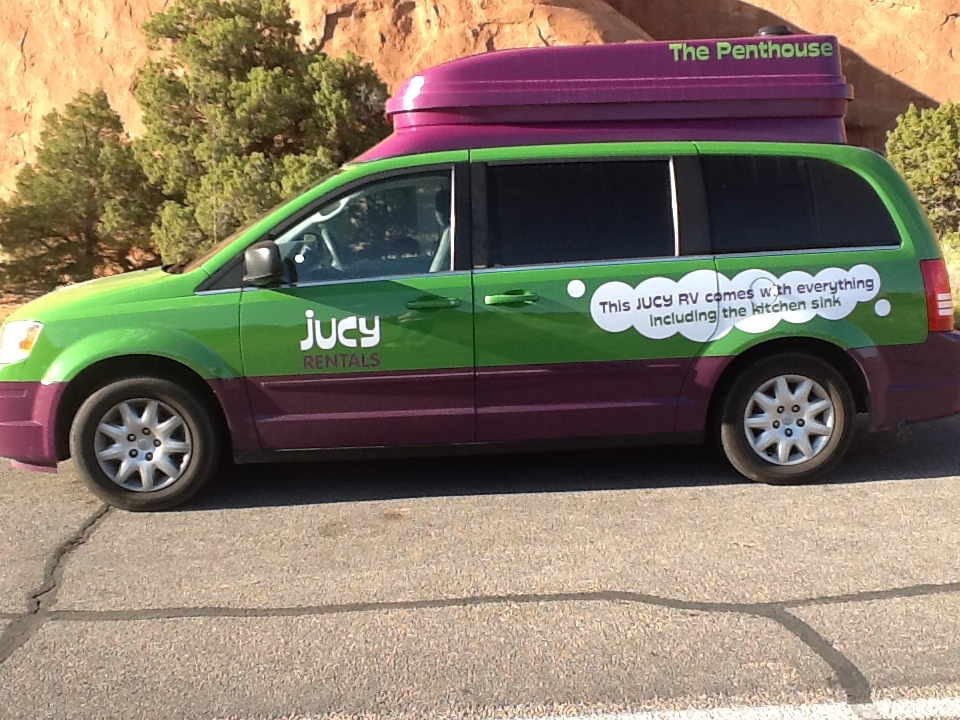

We saw these "Jucy" rental vans ALL OVER NZ!!!!! So excited to see one here! I approached the driver to discover that he had rented it in Las Vegas. He researched the company first and learned that the company was, in fact, founded in NZ and is growing!!!

These fins dwarfed Tom!!


Landscape Arch is an amazing sight1 Well worth the walk to get here. Warning signs to stay on the path and not be "under" the arch were frequently posted. The film we watched in the Visitor Center showed a brief video of the event....frightening....you can still see piles of the rock left.


Delicate Arch is the one on the Utah license plates. It was a 4 mile round trip walk to get close and watch the sun set.....we were too tired, so we took the lazy man's sight.....

Then we drove halfway back out of the park, found a high spot, sat on a rock and enjoyed the end of yet another beautiful day.